Moss Lake
Info
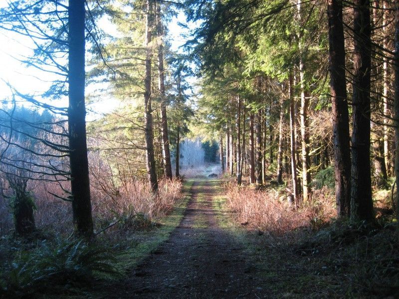
Moss Lake Natural Area is a King County Department of Natural Resources and Parks (DNRP) Ecological Land. The site is located 5 miles southeast of Duvall, 3.5 miles northeast of Carnation, and 1 mile east of Lake Joy in the Cascade foothills. The site is comprised of 372 acres of high-quality wetland and forested upland habitats. An extensive Class 1 wetland complex encompasses a large sphagnum bog, beaver dams, open water and forested wetland.
In November of 2024, the Tulalip Tribe purchased the land immediately north and east of the Natural Area boundaries. The tribe shares:
"The Tulalip Tribes respectfully ask the public to honor the boundaries of our “Skyline” forestlands, which are currently closed to public access. In November 2024, the Tribes acquired approximately 18,000 acres of the Snoqualmie Tree Farm — a landscape of deep ancestral significance. This land will be cared for as a working forest, supporting tribal programs and restoring the ecological richness in a way that would be recognizable to our ancestors.
As descendants of the Snohomish, Snoqualmie, Skykomish, and allied peoples who signed the 1855 Treaty of Point Elliott, our connection to these lands runs deep. We kindly ask that visitors refrain from entering Tulalip lands via adjacent areas such as DNR’s Marckworth Forest, the City of Seattle’s Tolt Pipeline Trail, King County’s Moss Lake Preserve, or neighboring timberlands. Campbell Global recreation permit holders are asked to remain south of the North Fork Tolt River on designated Campbell roads and lands.
The Tulalip Tribes are committed to working collaboratively with neighboring communities, agencies, and nonprofit partners to steward this forest with care and intention. If you have questions or would like to learn more, please reach out to ."

Moss Lake NA receives a modest amount of public use. There is a limited (official) trail system on the site, and users include hikers, equestrians and mountain bikers. There is a pit toilet and a parking lot for up to 16 cars or 10 cars and three busses.
Most of the trails are outside the park boundary and ownership of the rest is Weyerhaeuser, Hancock, and PSE. The area is defined by the pipeline to the north and Stossel Creek with the Tolt River to the South.
Photos
Videos
Trail Status
Ride Reports
After hearing over the years how this area can get real muddy, I wanted to get a good ride in during our drought to check out the trails. I got to the lot too early for the gate opening at seven so I parked outside and rode in. I played around on the trails near Orange Arrow and the loops just to...
Dryer than they should be for this time of year. Once you get off the main trails there a several fun loops to explore. Also thanks to the guy I saw there doing trail work on a Sunday. Great fun
Another way to do a long gravel loop in the snoqualmie forest (see https://www.gaiagps.com/public/3q5LI0TqU9Sraz2KS17GAqEo). Large part is similar to the one Tom Vale posted recently (thank you Tom Vale for inspiration) but it...
Relative to other Evergreen-supported trails, not many people ride Moss Lake. But it’s a great area with a small, dedicated group of unsanctioned folks who work hard to quietly maintain the trails (most notably is the infamous trail gnome, Bev). I ride here a few times each month and have recentl...
Rode this for the first time today, a hot day on the east side. Started from south trailhead and the Loop Trail and Winston Highway were in good shape. Bugs out in force but it was cool in the shade. Rode to the northwest and missed No Name in the clear cut. Followed the timber...
Headed to Moss Lake trails, looking for no crowds and a mild singletrack ride. I forgot I had been here before, albeit years back. I ended up doing quite a few segments, not in any particular order: orange arrow(?), no name, something highway, yellow loop, blue something or other, and...
Rode up Orange Arrow which needs a little love on the old road section. Loop is brushy but not too bad and the county will be running a brush hog through there soon. Other trails were in pretty good condition and all very ridable. Concering the previous post, yes, Memorial is hard to find from th...
I went for my first ride at Moss Lk. yesterday. Printed out the map and was glad to have it on the maze of intersecting roads and hard to find trails. Thanks to those who have worked out there and marked many of the trails.
I rode throught the gate to find the Fox Glove trail, but it appe...