Mount Catherine Loop
 (technical difficulty)
 (physical difficulty)
Info
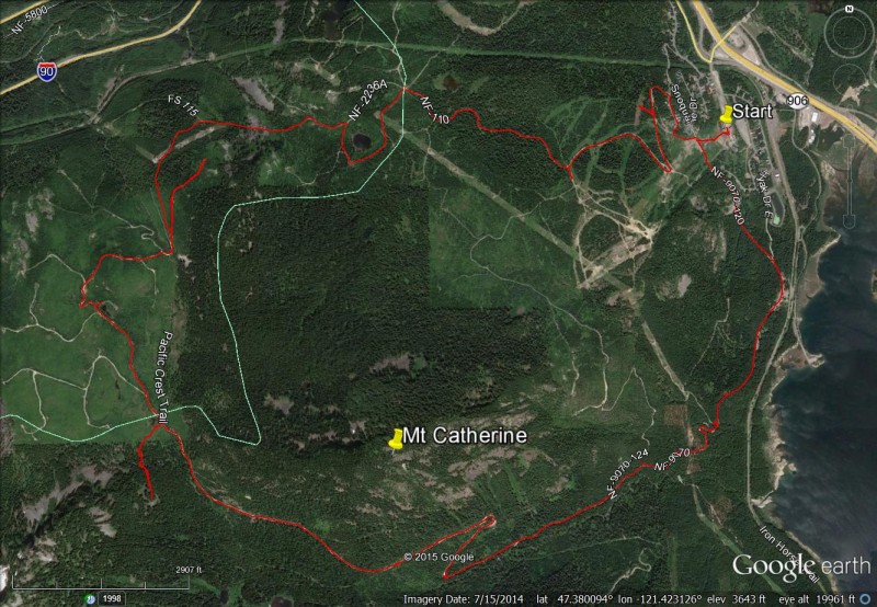
This is the forest service road loop around Mt Catherine (FS #9070) and equivalent to the Mount Catherine loop trial executed by cross country skiers from the Summit at Snoqualmie. As a biker, you park at the Hyak or Summit East lot and ride halfway up the intermediate slope to the road and traverse South or left. The road continues away from the ski area and begins the route to the back country just above the iron horse trail. This road is also used by vehicles to access the back country and the Pacific Crest Trail.
Photos
Videos
Ride Reports
Since the nordic ski season ended for the Summit I figured I'd make an early attempt on the cat track still existing. However the snow didn't freeze overnight and recent rains really softened it up so traction on normal tires was zero. Wait until the next freeze or further thaw to climb on the FS...
To be brief I would give this ride a big thumbs down.
I am currently getting ready for cyclocross season and so the official description of seemed to be on the money for what I wanted, that is a fire road with some elevation, something to get the legs burning. The fire road...
Was a pretty day for the Snoqualmie Pass area and afterward, I added a trip through and back through the tunnel.
Here is the GPS track and pictures at points of interest
For you Snoqualmie skier...