Thrilla Route
Key Info


Stats
General
Please be courteous to horses and slow down when you see them.
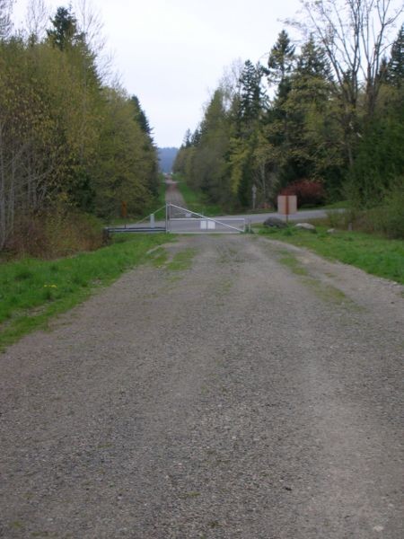
The Thrilla in Woodinvilla is a regular weekday conditioning ride on the Evergreen Ride Calendar. The route uses the Tolt Pipeline, Redmond Watershed and Puget Power Trails plus connecting sections of trail and double track for a killer workout.
The Puget Power Trail is gravel surfaced. Redmond Watershed can get a little muddy but it holds up well during wet weather. Tolt Pipeline is dirt doubletrack. Some of the dirt connector sections can get fairly muddy. Overall, the Thrilla route is a good dirt ride for wet weather conditions.
Redhook Brewery
Bothell Alehouse
Navigation
Note: The map marker points to the parking lot of the Redhook Brewery & Pub where club rides usually meet. If you're doing the ride on your own, there are other parking options listed below. It's okay to park in the side lot of Redhook, except summer movie nights.
To Redhook: From I-405, take exit for NE 124th St and head east (right) on NE 124th. Continue on NE 124th for about 2.25 miles down the hill and across the flat Sammamish River valley. Turn left at light onto SR-202 (aka Woodinville-Redmond Road). Drive approximately 1.5 miles and turn left at the light onto NE 145th Street. After a few hundred yards, turn right into the Redhook Brewery parking area before crossing the RR tracks. Go straight towards the brewery building, and turn right to park in the east end of the parking lot.
Public parking lot near ball fields just off the River Trail These are a few hundred yards east of the brewery, between the Sammamish River and 148th Ave NE.
From Redhook, ride back to the pedestrian bridge over the river and head south along the paved Sammamish River Trail (an extension of the Burke Gilman Trail) towards Redmond. Cross under the bridges at 124th St and 116th St. About 3.5 miles from Redhook, look for the high overhead power lines. The Puget Power Trail (PPT) begins under the power lines, just before some apartment buildings. Turn left onto the PPT and climb up to the crossing of SR-202 (aka Redmond-Woodinville Road). Cross over SR-202 and continue climbing. After cresting the hill, the wide gravel PPT crosses several roads. Stay under the power lines and look for the trail continuing on the other side.
After a couple more descents and climbs, the trail descends down to Avondale Road. Use the pedestrian signal and cross to the other side. Parallel a wood fence and then cross over a creek on a bridge. Careful, the dirt road is a driveway so keep an eye out for vehicles. Immediately after crossing the creek, see a sign for the PPT and turn left. Wind through the woods on the wide dirt trail, stay straight at a 4-way trail intersection and take lefts at the next two intersections. The PPT climbs a short hill under the overhead power lines before it comes out on a paved road. Take a left at the road (196th Ave) until it tees into 116th St. Turn right and climb up to a stop sign at Redmond Road. Continue straight at the stop sign and take the next right onto 206th Ave. The road descends and then turns left under the power lines. Take the bark trail straight ahead up "Horse Pasture Hill" and climb towards a fence.
On the right side of the fence, find a trail that parallels the fence. Climb up and at the sign for the Redmond Watershed vear right onto an established trail. The trail comes back under the power lines where you take a right. Follow under the power lines and after crossing a 4-way intersection look for a short section of trail on the right. The trail crosses under the power lines again and then descends to a bridged creek crossing before climbing again. At the top, take the left trail (the other two lead back towards Novelty Hill Road).
Stay on the main trail through the Watershed. Each intersection is signed. After several climbs and descents, you'll come back out on a level section of trail before diving back into the woods. Enjoy the descent (keeping an eye out for oncoming trail users). Pass by the first trail intersection (hiker only) and take the second intersection to the right on the Collins Creek Trail.
The trail winds back and forth before coming to a soft T intersection where you stay left (right is hiker only). Stay straight across two street crossings (the second is traffic signal controlled). Wind back and forth until you come out in a development. Stay to the left of the stormwater pond and come out on a paved road. Veer right across the road and go through the wood bollards onto a gravel trail. Left at the first intersection and then left again along another stormwater pond.
The trail will cross a couple wood bridges and then climb sharply to the right. At the top, stay left and follow the trail behind the houses. After climbing a bit, you'll come out onto the Tolt Pipeline where you'll take a left.
The Tolt Pipeline will stay essentially straight for the next 5 miles. A few descents and then one longish climb. Two more steep descents and after crossing another pedestrian bridge, climb to the top onto a dirt road. Stay straight and descend steeply down through the gate. Pay attention and watch your speed down the hill. If you are experienced (or want to be) with the final steep hill: [the fastest way without having to cross over the rivulets is on the left side right after the gate. Try it out first in daylight when it's not too sloppy, and watch out for the 2 or so sections where the stream bed slightly cuts into the path from your right. About 2/3 of the way down between the first gate and the residential road (not 202), you can ease back into the middle. [NOTE there is now a section of singletrack, on the extreme left side of the hill, which will take you approx. half-way down the hill - No Ruts!] Slow down on the small paved section before the residential road and take the left path. About half-way between the residential road and the gate, there will be a diagonal path to the right (where the gate opening is) that is less muddy and easier to slow down on than if you took the right side after the residential road. Don't count on braking hard once you're on the right side; if it's at all muddy then you should slow down before you get to the right side (and the gate). Once you're through the gate, the fun part is over; look forward to that descent next time. Once you get used to it, you won't even have to slow down until the diagonal before coming to the gate, just be sure to slightly increase your speed each time.] After crossing Hwy 202 (be very careful) go through the gate again and stay straight towards the Sammamish River. Once you intersect the paved Sammamish River Trail, turn left and complete the loop to Redhook.
Extensions
While the base "French Vanilla" Thrilla is approximately 20 miles, there are many extensions and it is possible to ride a 45+ mile figure eight loop utilizing all the single track options and the other piece of the Tolt Pipeline west of Redhook between Woodinville and Bothell.
A 39 mile version of the Thrilla is detailed here. It's ridden in the reverse direction (clockwise) and utilizes the following extensions: K-Pile, Gold Creek Park (Tree, Triangle of Death, Back in the USSR out and road loop) 10 Acres, Sheffield, back up Last Lonely Hill to the concrete blocks, left loop to Hell of South, 6321, Redmond Watershed, Powerline road, Redmond Ridge Trails, Powerline road, Redmond Watershed, Tuscany, EMT Trail, Tennis Court Trail, Perrigo Heights, Ballfield (w/ little hill up to fallen tree), and High School Trails.
Another extension is doing the Trilogy Trail, this adds 2.7 Miles. As you exit the watershed on the east exit (Collin Creek Trail), take a sharp right uphill after the sign that indicates you are leaving the watershed, this will climb up behind some houses. You will see the Trilogy golf course, continue on the main trail until you reach Novelty Hill, return through the same route and continue right onto the remaining Thrilla.
Ride Reports
Duvall Park to the North Fork Tolt
Was a great ride during the White Christmas of 2017. I did the Tolt Pipeline East of the Thrilla but thought it would still provide information for the folks who haven't gone as far. Parking at Duvall Park and then riding East until the watershed restricted gate at the North Fork Tolt bridge. If...
Clockwise 20 miler while the rain stopped
Did this route for the first time. I parked at the ballfields and went clockwise up the pipeline. A good climb. This is a nice workout but the dampness was a little slippery so corners on the double track, or wide paths, were slick. Nice morning out. Read more
Go with someone who has done it before
My basic advice for this ride is go with someone who knows the route. There are a lot a places where you can make a wrong turn once you get to the Horse Pasture Hill and Redmond Watershed section I will have to wait until a Thursday night to do this ride with folks who know the route&...