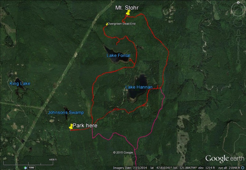
Lake Fontal and Mt. Stohr
 (technical difficulty)
 (physical difficulty)
There are several locked gates in this area and parking at the first one you see might be advised. CYO Camp Hamilton is nearby. It is a kids camp and access might be limited when in use.
Info
This is a ride of dirt roads to Lake Fontal and Lake Hannan and an additional trip to the 1400' peak (Mt. Stohr) to the northeast. It is about 3 miles from the north side of the Cherry Valley system and Lake Margaret. A USGS map shows a road that ties this ride to the Cherry Falls access road if you want to lengthen the ride to single track!
Photos

Videos
Ride Reports
Started early at the Cherry Valley trailhead heading for the Falls and then North to summit Mt Stohr.
Since the full suspension is in the shop, this ride was a gravel ride. The bike trail to Cherry Falls is getting overgrown from the wet spring we had but it is still doable. I crossed Mar...
Drove to the gate; posted as private property. We didn't feel welcome so we left. Anyone know what the rules are out here? Is it actually okay to ride here?
It has been 4 years since I first explored this area. This time, I started at the Cherry Falls trailhead and took the road to the Falls trail and then the Falls trail to the falls, and then started north on the lesser travelled roads. After some exploring around Lake Hannan, I continued up to the...
Added this trail to the site. It is the 1400' peak to the north of Cherry Valley. At the top it has a small view of Mt. Baker and some views to Monroe and Sultan. It was a nice ride for exploring. Next time I'll try linking to it from the Cherry Valley side if that is possible as shown on maps. R...